Here are the main components of my ecosystem:
- Python, C++, R, PostgreSQL, Vue.js
- Git, GNU/Linux, Neovim
- Docker, Docker Compose, Proxmox
In my spare time, I like building some side-projects such as my homelab. I also love climbing and hiking, and I have a very cute cat named Harold.
Work
Software Engineer - INRAE, UMR IGEPP
[February 2025 - now]
- Automation of insects tracking through image sequences
- CVAT server administration, deployment of fine-tuned models (using the Nuclio platform) for semi-automated annotations
Engineer - INRAE, UMR IGEPP
[May - July 2024]
- Modelling the spatio-temporal diffusion of spores using public geographic databases
- Data exploration using visualization tools and statistics
- Streamlit web interface
Doctoral student - INRAE, UMR LISAH
[September - December 2023]
- Worked on the Pl@ntNet project
MSc Internship - INRAE, UMR IGEPP
[January - July 2023]
- Spatio-temporal Fisher-KPP growth model
- Image segmentation neural networks
- Work on computing servers and cloud platforms
Supervising
Océane Gourdin (now PhD student at UMR IGEPP)Teaching
Online Collaborative Resources at University of Rennes (Fall 2025)Pinned projects
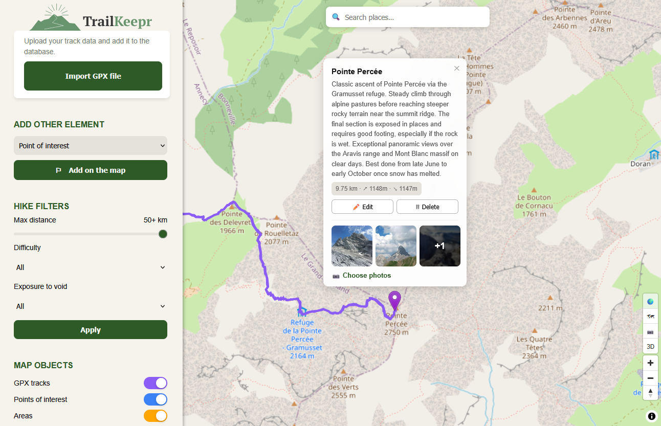
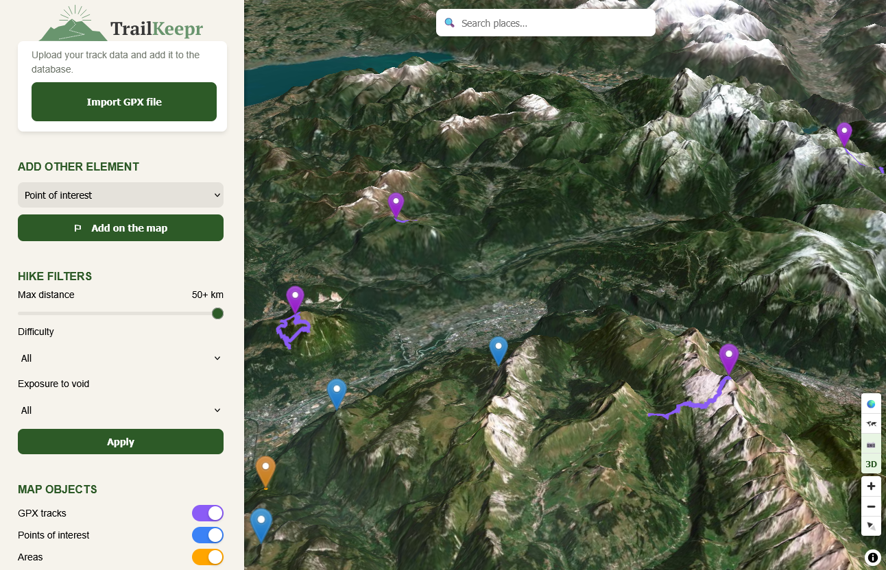
Trailkeepr
|
|
A self-hosted web service designed to archive and explore hiking routes and outdoor places. It combines an interactive map interface with a spatial database to store GPX tracks, places or areas I visited. The backend is built with FastAPI and connects to a PostgreSQL database extended with PostGIS to handle geographic data. GPX files can be imported and parsed automatically to extract route geometry and elevation statistics. The Vue.js frontend uses Maplibre GL JS to render the interactive map.
Home Server Infrastructure

A collection of self-hosted services that I use daily. The initial goal of this project was to get better experience with system and network administration, but it quickly escalated into a fascinating pool of experimentation. Here are some of my deployed services:
- AdGuard DNS sinkhole
- Nginx Proxy Manager
- Tailscale VPN
- Vaultwarden password manager with scheduled backups
- Proxmox running VMs
- Cadvisor, Prometheus, Grafana
This infrastructure is designed to be energy-efficient for both economical and ecological reasons. This was a primary criterion when picking hardware for building my servers. On the software side, I almost exclusively use containerized services (Docker, LXC), and limit my use of virtual machines (which I still occasionally use for testing new things) to save even more power.
Msc Internship project : late blight growth model

A model built to describe the growth of late blight lesions on potatoes. This project was supervised by Melen Leclerc (IGEPP, INRAE). It leverages efficient image registration techniques, as well as deep image segmentation algorithms, before building the reaction-diffusion model itself.